 |
||||||||
 |
||||||||
 |
||||||||
 |
||||||||
izdavaštvo i grafičko oblikovanje
Cijena: 12 EUR
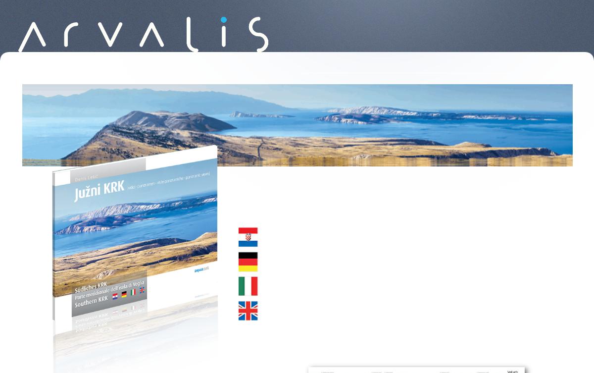
Južni Krk je zemljopisni pojam koji obuhvaća jednu posebnu cjelinu otoka. Taj prostor počinje u zaleđu Punta i Vrbnika te se proteže visoravnima i njihovim strmim padinama koje zatvaraju Bašćansku dolinu, uz Staru Bašku jedino naseljeno područje tog dijela otoka. Na prvi pogled, visoravni su prostor gotovo netaknute i “surove” prirode, obilježene snažnim utjecajem vjetra. Prostor koji je tek dotaknut ljudskim djelovanjem. No “na drugi pogled”, to je ipak kulturni krajobraz, itekako prožet mnogočime ljudskim. Vidici prikazani u ovoj publikaciji nasumičan su odabir pojedinih lokaliteta, možda i kao priprema za neko opširnije izdanje. Može se reći da je ovo i nadopuna izletničkim kartama koje izdaju turističke zajednice Punta i Baške. Nadopuna koja vas pokušava ”zavesti” kako biste i sami osjetili potrebu posvjedočiti ovaj prostor ili barem neki njegov dio.
Denis Lešić
JUŽNI KRK - vidici
Südliches KRK - panoramen
Parte meridionale dell’isola di Veglia - viste panoramiche
Southern KRK - panoramic views
„Südliches Krk“ ist ein geographischer Begriff, der eine besondere Einheit der Insel umfasst. Dieses Gebiet beginnt im Hinterland der Ortschaften Punat und Vrbnik und erstreckt sich über das Hochland und dessen steile Abhänge, die das Baška Tal umschließen, das, neben der Ortschaft Stara Baška, das einzige besiedelte Gebiet in diesem Teil der Insel ist. Auf den ersten Blick scheint das Hochland ein Raum der unberührten und "rauen" Natur zu sein, gekennzeichnet durch die starken Einflüsse des Windes. Ein Raum, der durch menschliche Einflüsse nur leicht berührt ist. Aber auf den zweiten Blick ist es doch eine Kulturlandschaft, die allerdings von vielem Menschlichen durchdrungen ist. Die in dieser Publikation abgebildeten Panoramen sind eine zufällige Auswahl einzelner Standorte, die vielleicht auch als Vorbereitung für eine spätere, ausführlichere Ausgabe betrachtet werden können. Man kann auch sagen, dass dies eine Ergänzung zu den Ausflugskarten ist, die die Tourismusverbände von Punat und Baška herausgeben. Eine Ergänzung, die Sie dazu „verführen“ versucht, selbst auch den Drang zu verspüren, dieses Gebiet oder zumindest einen Teil davon zu erkunden.
La parte meridionale dell’isola di Veglia è un’area geografica che comprende una zona speciale dell’isola. Quest’area inizia nell’entroterra di Punat (Ponte) e Vrbnik (Verbenico) e si estende sugli altopiani e sui pendii ripidi che circondano la valle di Baška (Besca), oltre Stara Baška (Besca Vecchia), unica area insediata di questa parte dell’isola. A prima vista, gli altopiani sono contraddistinti da una natura quasi intatta e “selvaggia”, risultato della forte attività del vento. L’ambiente è quasi intatto e non risulta intaccato dall’attività umana. Tuttavia, se lo si osserva con maggior attenzione è un ambiente permeato dagli interventi umani. Le fotografie riportate in questa pubblicazione sono correlate a una scelta casuale di singole località o forse anticipano un’edizione atta a sviscerare al meglio quanto qui accennato. Si può asserire che quello che troviamo in questa pubblicazione va a supportare le mappe escursionistiche rilasciate dagli enti turistici del comune di Punat e di Baška. Un supplemento che cerca di “sedurvi” e, al contempo, farvi sentire la necessità di essere testimoni di quest'area o almeno di alcune delle sue parti.
Southern Krk is a geographical term referring to a part of this island of its own. This area begins in the hinterlands of Punat and Vrbnik and extends through the two plateaus and their steep slopes that enclose the Baška valley, besides Stara Baška the only inhabited area in that part of the island. At first sight, the plateaus are an area of an almost untouched and “harsh” nature, marked by a strong influence of wind. The area which has been barely touched by human hand. However, looking at it more closely, it is a cultural landscape very much imbued by a lot that is human. The panoramic views presented in this publication comprise a random choice of certain localities, perhaps in preparation for a more comprehensive edition. They could also be seen as a kind of supplement to the excursion maps issued by the Punat and Baška Tourist Boards - a supplement that is trying to “seduce” you to feel the urge to bear witness to this area yourself, or at least to some of its parts.